Project origins
In 1854, John Snow mapped cases of cholera in London and pinpointed the source of outbreak to a single water pump. These days, maps and spatial data continue to play an important role in epidemiology and public health, particularly for a disease like Ebola.
One of the main ways to contain a disease like Ebola is through contact tracing – identifying everyone a patient has been in contact with, locating them, and warning them to limit contact with others. However, it’s much more difficult to do this when a patient is brought to a medical facility and tells the staff where he is from, but that place doesn’t exist on any maps, or when the staff have only very basic information about that place. Detailed maps facilitate public health work, as well as other humanitarian and development activities.
When the 2014 Ebola outbreak began, HOT coordinated remote mapping volunteers, who did amazing work to add roads and buildings to the basemap for West Africa. There is more to be done, however. West Africa remains a vulnerable region with a fragile health system, and there is a need to keep OpenStreetMap up to date and to add on-the-ground details – both for development purposes, and in case a health issue arises in the future.
So we are mapping a HUGE area in West Africa
This past year, the American Red Cross undertook its biggest field effort to date: launching a mapping hub in West Africa and training local volunteers to field map over 5,000 villages in the border regions of Liberia, Guinea, and Sierra Leone. The mapping focuses on public health resources, different aspects of vulnerability, and amenities like markets that would draw people across borders – important information to understand if another outbreak were to occur.
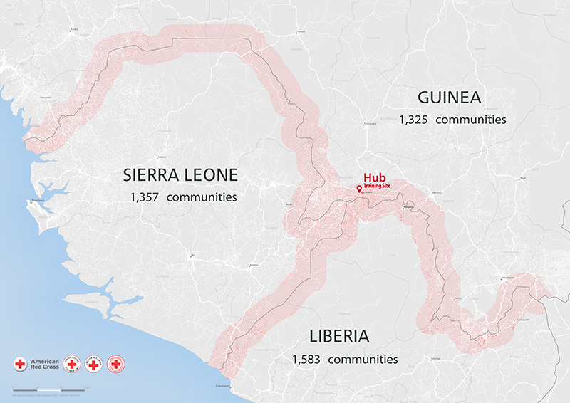
The project area includes everything shaded pink. Each tiny red dot represents a community to be mapped. CC-BY American Red Cross.
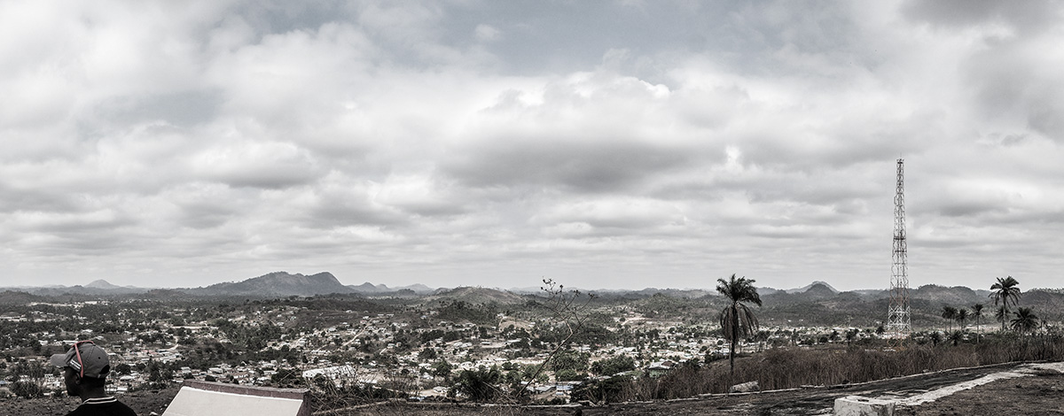
Covering an area nearly as large as Switzerland, this project was a massive effort to scale up our Missing Maps field efforts in a rural region full of technical challenges: no connectivity, extremely poor roads, lack of electricity, dispersed volunteers, varying languages, ongoing health challenges, political challenges, etc.
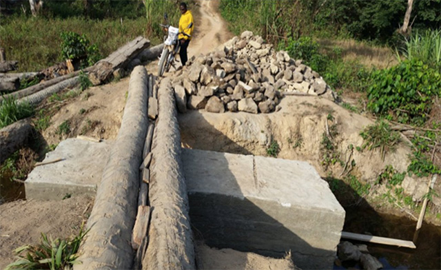
Road quality is a major issue, but our volunteers manage to make it through. Photo courtesy of Lofa Chapter Red Cross volunteer.
Where to start?
Since November, we’ve been hard at work to figure out what exactly it takes to carry out such a large project: How many volunteers are needed? How long will it take them? What sort of tools should we use? How can we manage volunteers when they won’t have a cell phone signal for days at a time? We’ve also been recruiting and training local staff to oversee the project.
In March, we were finally ready to begin mapping. Local staff, together with the GIS team from DC, travelled to three field sites in Liberia to train local volunteers in mapping and data collection. The volunteers learned to use OsmAnd, ODK Collect, OpenMapKit, and paper-based tools like FieldPapers, then they set off on motorbikes to start visiting their target communities.
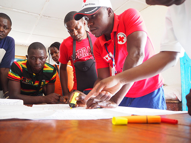
Red Cross volunteers prepare for field mapping in Liberia. CC-BY American Red Cross.
The mapping takes place in two phases: first, the volunteers visit each community and conduct a brief survey with the village leader, and visit any health facilities that may be present. Next, we assess the vulnerability of the communities and return to the most vulnerable communities to conduct much more detailed mapping. Results will be shared with the Red Cross, other NGOs, and different communities in order to better understand key needs and to be prepared for future activities.
Fancy new technology!
For equipment, we brought 100 Blu phones that had been set up with our mapping apps, as well as large-format paper maps of the counties. We also brought our new portable offline servers, POSM (Portable OpenStreetMap).
POSM is a new tool developed for working in rural areas like West Africa. Over the past couple of years, the American Red Cross GIS team has been using and developing some fantastic tools for mobile data collection and mapping, but there are certain constraints for using them in a really remote area – it’s difficult to be offline for more than a couple of days when an internet connection is required to prep map tiles or FieldPapers atlases, to download areas of OSM, to push data off of a phone, etc. And, if something goes wrong, we have to resort to paper-based methods or back-up plans.
With POSM, we can pre-download all the data for an area of interest before we travel to the field. Then, when we need to prepare for field mapping or lead a mapathon, we just power up the POSM box and wirelessly connect a phone or computer to it. POSM allows us to do all of our core tasks without an internet connection, for potentially months at a time. The software is free and open-source and available here.
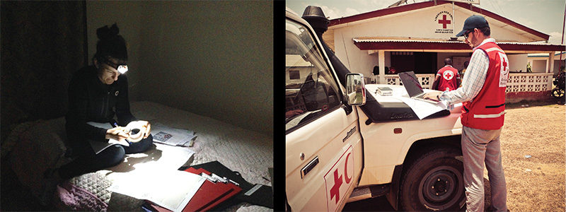
Left: Before POSM, tech problems meant taping FieldPapers together by headlamp. Right: With POSM, we can fix problems and prep mapping on-the-fly. CC-BY American Red Cross.
Physical presence in the area
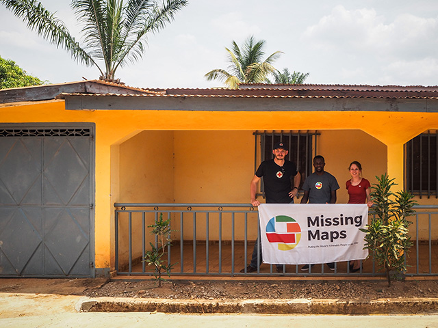
We’ve also launched a mapping hub at the heart of the cross-border area, in Guéckédou, Guinea. The hub is a physical office space with equipment, staff, and resources to lead trainings and outreach, and to engage with the local community. The goal of the space is not just to facilitate our mapping activities, but to provide longer-term and more sustainable engagement in the area and to foster a local community of mappers.
Checking out the new hub facility before it gets set up. CC-BY American Red Cross.
With this facility, these tools, and our tireless volunteers, the mapping is nearly complete for Liberia and is now beginning in Guinea and Sierra Leone. We’ll post more updates as the data collection unfolds over the coming weeks!