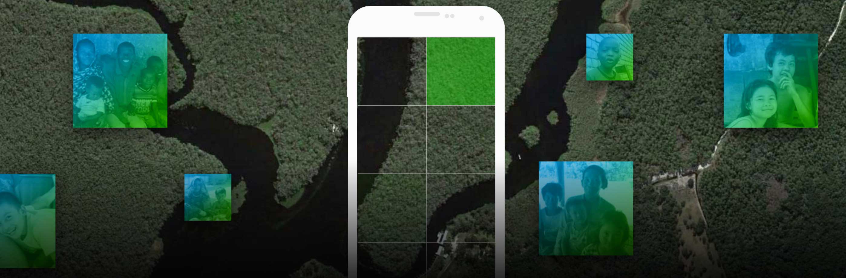
MapSwipe: How to map from the satellite imagery!
First of all, thank you so much for contributing to the Missing Maps project via MapSwipe. We are blown away by your response so far!
Many of you have been in touch to give your comments, suggestions and bug reports. We’d like to try and address one of the main requests: guidance on mapping from the satellite imagery.
MapSwipe pro tip - did you know if you hold down a tile it will zoom so that you see it more carefully?
Mapping is never straightforward. Buildings and roads differ hugely from country to country. This blog post aims to give some examples but is by no means comprehensive. In the future, we also hope to build training and support into the app. Please feel free to keep your feedback coming!
We will be looking at imagery from the Niger State (Nigeria) missions for the following items:
Buildings:
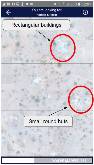
There are two main types of building in this area; rectangular structures with metal or wooden roofs and round huts with roofs of straw.
Building examples
The rectangular buildings are much easier to spot as they are generally square and usually fairly large. The round huts, however, are often smaller and blend more into the landscape. You can see the differences in the examples below.
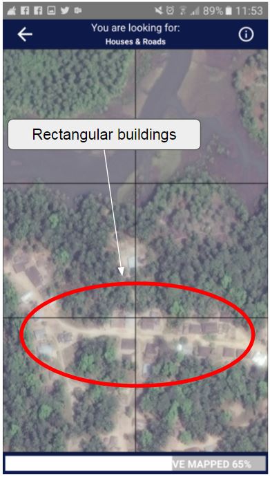
Rectangular buildings
The round huts can be differentiated from natural features, such as trees and rocks because they usually appear to be a (near-perfect) circle. They are also often grouped together into villages or hamlets.
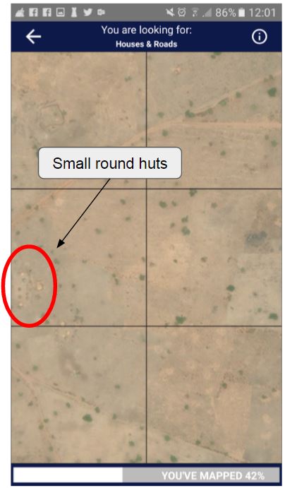
Round huts
It is very important that we try and identify all structures in this task, so take your time when swiping and look out for these groups of shapes. Remember, if you are unsure you can always tap it twice to turn the tile yellow indicating “maybe”. It is often better to be on the safe side and tap to indicate a feature as other mappers will review and map the areas you have identified.
Roads:
Road and tracks are sometimes easy to see and sometimes very faint in the satellite imagery. Major roads are usually obvious, but the smaller paths can be tricky to identify. Many people have asked whether we want them to map just major roads or paths and tracks as well. Unfortunately, it is not that simple!
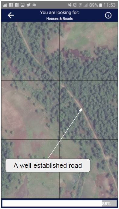
Road example
What we need is the road networks. This will always include well-established roads. Does it include tracks and paths? Sometimes!
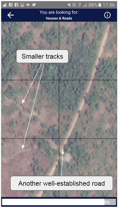
Road and path examples
If a track or a path leads to a village or hamlet (or to a larger road), we need to know where it is. If it leads to a field, it is not necessary to map. However, because you only have a limited view of the area, it is often difficult to tell. It’s a good idea to swipe left and right to see if you can see where the path or track goes.
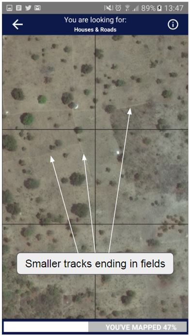
Dead end path examples
So, where you see that a track or path ends before hitting a village, hamlet or another road, please ignore it. Otherwise, please identify it. Remember, if you are unsure you can always tap it twice to turn the tile yellow indicating “maybe”.
Rivers and river beds
In the example above, you can see there is a dry riverbed. We are not generally asking for waterways to be mapped in these tasks, but it looks like this one is also used as a path, so we would ask for it to be mapped.
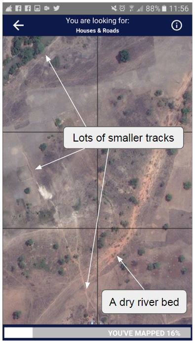
River bed example
Often, you can identify a river because they meander, whereas roads tend to go straight from one place to another. Swipe left and right to see how the feature moves if you can.
If you are unsure of anything, it might be best to double tap the area to indicate a possible feature as other mappers will come later to map the areas you have identified and they will be able to check.
Bad imagery and clouds
By triple tapping on a square turning the tile red, you can indicate that you cannot see the landscape. This could be because you have encountered an absence of imagery, poor quality imagery or clouds.
The ‘'’camera icon’’’ in the first example means there is no imagery available for this area. Triple tapping here is important because it lets us know where we need to find alternative sources for imagery.
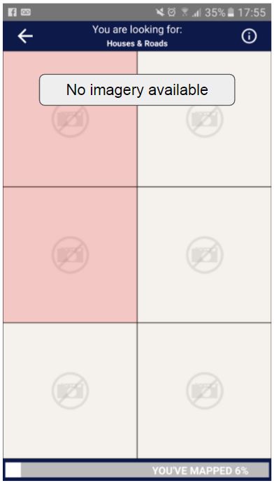
Missing imagery example
In the second example, you would triple tap because the cloud is obscuring your view of the area.
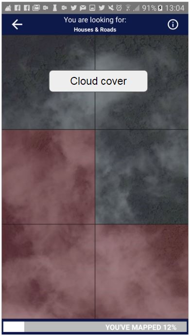
Cloudy imagery example
However, in the third example, there is a little cloud, but you can see clearly that there is nothing underneath it, so you can swipe this one.
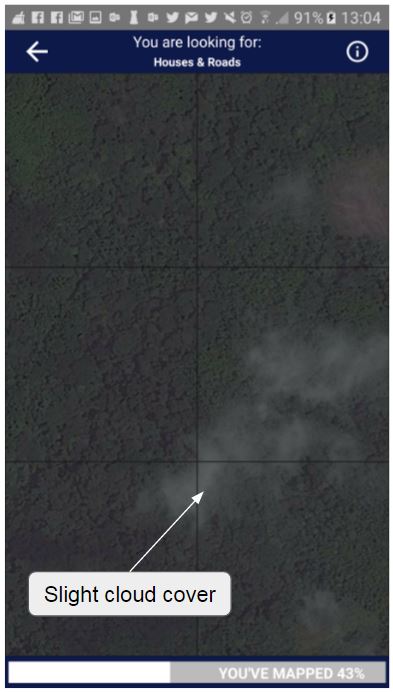
Cloudy imagery example
And, finally…!
We hope this is a useful resource for you. Please feel free to share it so others may also benefit. If you have any feedback on this or any other aspects of MapSwipe, please feel free to use the feedback form.
Also, remember that no one person is responsible for any area. Multiple people look at every tile. If you miss something, others might see it. Although, obviously, please try not to miss anything ;)
Thanks again for helping humanitarians…..