
Downloading MapSwipe means that in a matter of minutes you can contribute to the work being done around the world by MSF, the Red Cross and others, and all from the comfort of your own phone!
Using MapSwipe
In a humanitarian crisis, the location of the most vulnerable people is fundamental information for delivering food, shelter, medical care and other services where they are most needed. And, although it may be hard to believe, millions people around the world are not represented on any accessible map.
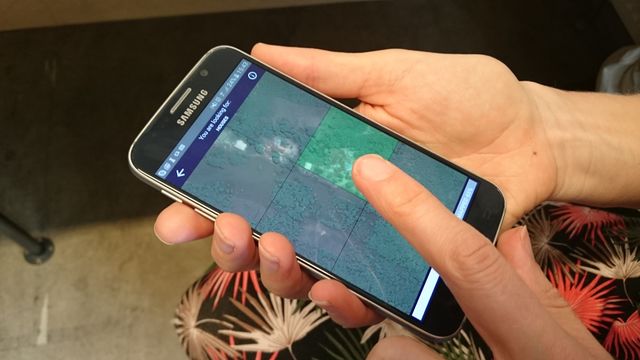
Part of the Missing Maps project, MapSwipe enables anyone with a smartphone to contribute to the mapping of these vulnerable communities. Download the app, choose a mission, read the instructions and get started! One tap identifies features, a second tap indicates possible features (if you’re not sure) and a third flags cloudy or bad quality imagery areas. If there is nothing to identify, just swipe to the next image! You can download imagery for offline MapSwiping on an underground train or plane, so say goodbye to your wasted commuter hours on Candy Crush or Angry Birds!
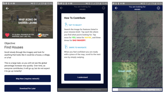
Screenshots from MapSwipe
Developed by Medecins Sans Frontieres / Doctors Without Borders (MSF), MapSwipe serves a direct purpose for NGOs. For example, when MSF responds to major disease outbreaks with mass vaccination campaigns, hundreds of teams have to cover enormous areas (as in the measles outbreak in Democratic Republic of Congo last year). Now, with MapSwipe, we can give vaccination campaign coordinators a super-fast snapshot of where the population clusters are, helping them to send their teams to the locations where they are most needed to achieve maximum vaccination coverage.
The Missing Maps project is a collaborative project in which a large and committed community of NGOs, academic institutes, companies and most of all individual mappers map vulnerable areas in OpenStreetMap. By using MapSwipe to identify where communities are located, you also give these mappers the ability to use their talents to map the towns and villages in these areas without having to search through miles of jungle and bush to find them, saving time and helping to put valuable data into the hands of field teams even faster.
So, get the app. Tell your friends. And, let us know what you think!
Happy mapping!

NB. The satellite imagery we use is generously provided by Bing / Microsoft Corporation (who also make a huge amount of imagery available for OpenStreetMap). Unfortunately, a bug in the MapSwipe app currently prevents us from displaying attribution appropriately. We are working to get this fixed!