
14 July 2023 | by Melanie Eckle and Alec Schulze-Eckle
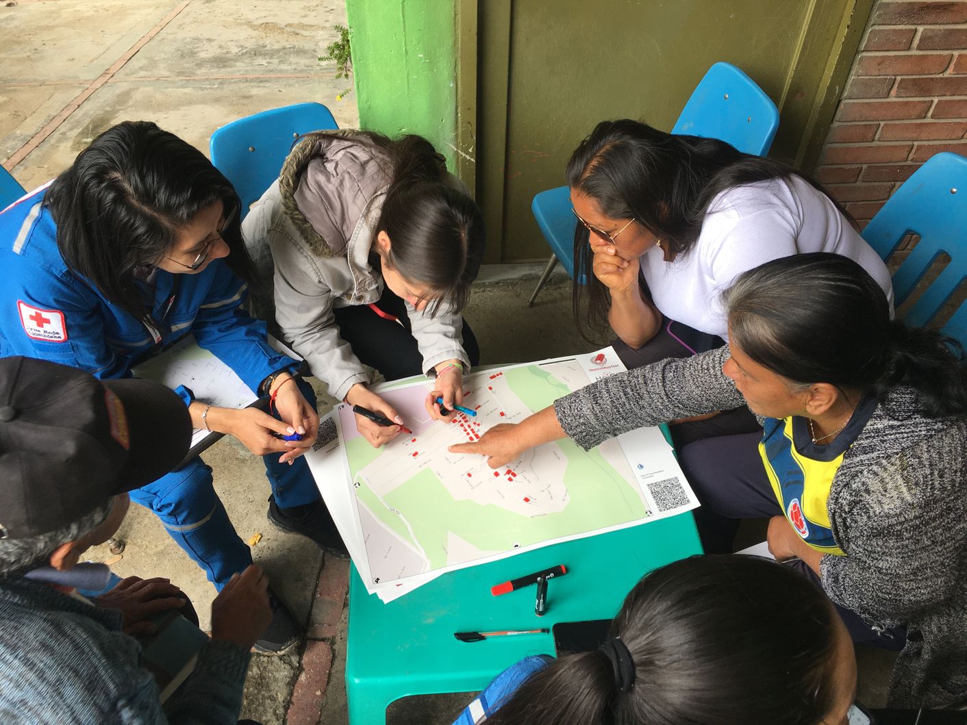
The Heidelberg Institute for Geoinformation Technology team recently launched a new version of the Skecth Map Tool - an easy-to-use tool for participatory sketch mapping through offline data collection, digitization and georeferencing of local spatial knowledge.
19 June 2023 | by Jana Bauerová
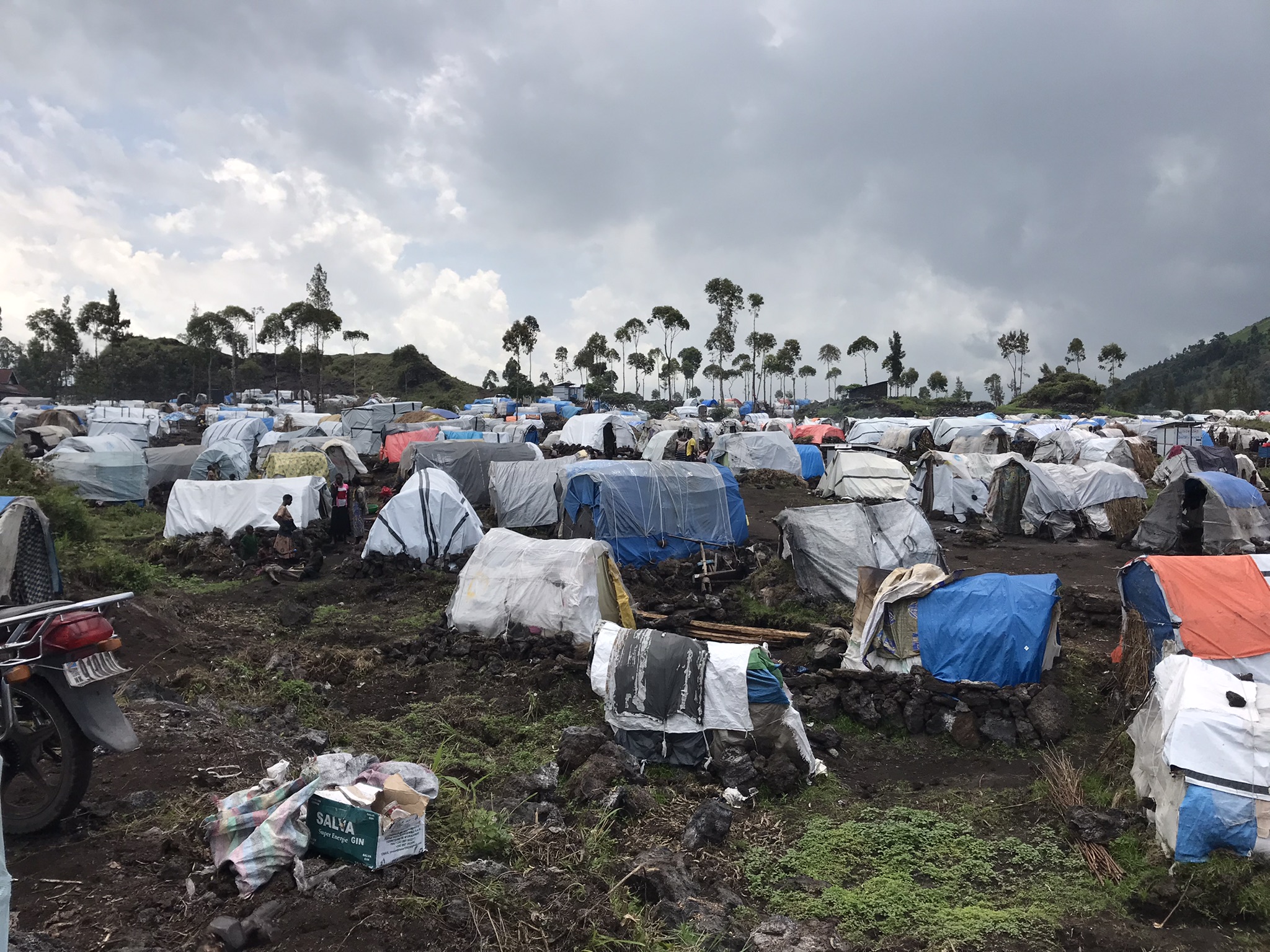
Amidst the ongoing conflict and displacement crisis in the Democratic Republic of Congo, utilizing geodata contributes to an effective evaluation of the situation, understanding the extent of displacement in a setting where estimating the number and spread of population is never an easy task.
02 June 2023 | by Jana Bauerová, Sophie Gélinas-Gagné and Alexis Huart
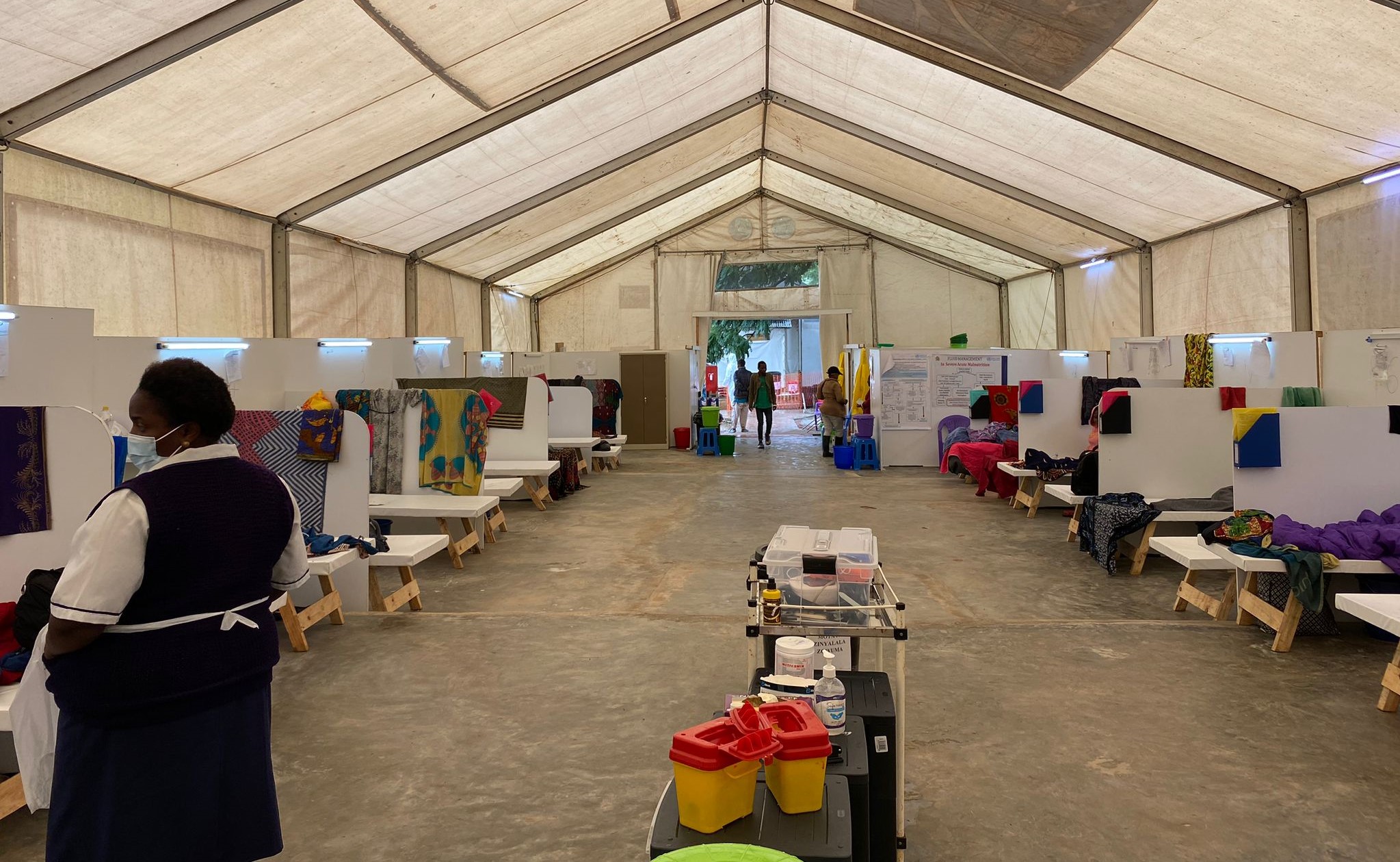
Malawi was experiencing the worst cholera epidemic in 20 years, so MSF sent an emergency team and activated Missing Maps. When a cyclone hit in March, OSM data was also invaluable for assessment.
08 March 2023 | by Jana Bauerová
For the International Women's Day 2023, three women validators from different countries shared their unique perspectives
28 November 2022 | by Laurie Boobier
MSF used geographical information to map air pollution risk with help from Missing Maps volunteers who updated valuable OpenStreetMap (OSM) road and building data sources.
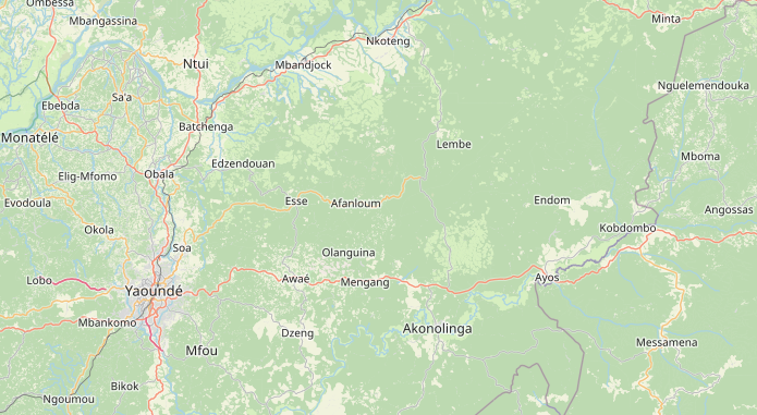
14 October 2022 | by Yves Emmanuel Nikoyo Emougou, Jorieke Vyncke, Lale Pirlot
In order to improve Cameroon’s landcover and landuse mapping, OSM Cameroon strived to collect better data and enrich the OSM map that shows landcover patterns across the country.
08 September 2022 | by Benni Herfort, Sam Colchester
In the past years several examples highlighted how universities and research institutions can complement Missing Maps’ work. Here we want to share some lessons learned and dig into the things that can be done beyond organizing mapathons.
15 August 2022 | by Laurie Boobier
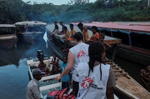
To respond to this cyclone emergency in Madagascar, Médecins Sans Frontières (MSF) used a new innovative MapSwipe method developed by the Heidelberg University.
30 March 2022 | by Jana Bauerová and Melanie Chabot
Read about the inspirations, passions and wisdom behind three all star OSM mappers

15 February 2022 | by Jessica Bergmann
Sustaining livelihoods amidst COVID-19 shutdowns using MapSwipe. In Bamako, Mali, more than 100 individuals whose livelihoods were affected due to COVID-19 participated in the pilot program.
25 January 2022 | by Dan Joseph
American Red Cross is excited to support a new MapSwipe mission type available in the v2.1.8 release.
30 November 2021 | by Jana Bauerová
Between summer and mid-Fall, several countries have experienced life almost as we knew it before the pandemic, including live events taking place again with the previous restrictions lifted. A few of us have taken the opportunity to switch from online to in-person mapathons.

26 May 2021 | by Melanie Chabot, Rachel Levine & Jorieke Vyncke
We have collected the stories of several enthusiastic OSM-ers who have mastered the art of mapping their own backyards. They have offered their advice for those who are first starting out and shared the reasons why they have become so passionate about local mapping.

29 April 2021 | by Melanie Chabot & Rachel Levine
We are so excited to announce the launch of our refreshed website! Over the last year, the Missing Maps team has focused on this project to ensure that you, our wonderful mappers, have everything you need to best participate in the OSM Community.

29 January 2021 | by Jana Bauerova
Building on the first year of pilot Indoor Residual Spraying campaign, the Médecins Sans Frontières (MSF) recently conducted a second round. Lessons learned could be incorporated during the repeated exercise and results are encouraging.

28 December 2020 | by David Garcia
International cooperation in mapping is important, but who is really leading?

24 November 2020 | by Laurent Savaëte
Why we're setting up a collective to support MapSwipe

26 October 2020 | by Paul Knight
Back in February, the Missing Maps Project was awarded the Cruz Roja Award at the Red Cross Humanitarian Technology Awards (IV Edition)

24 September 2020 | by Katharina Lorenz
In order for FbF to work, we need to decide quickly, when and where to act.

28 August 2020 | by Geoffrey Kateregga
In this article we concentrate on Human Centered Design and how you can help us to build a platform that meets the needs of the people using it.
29 July 2020 | by Sam Colchester, Melanie Chabot, Rachel Levine, Léonie Miège
I realized right after the French lockdown that online mapathons were very important to me during this isolation period.

29 May 2020 | by Mark Herringer
In this article we concentrate on Human Centered Design and how you can help us to build a platform that meets the needs of the people using it.

30 April 2020 | by Jennifer Duong, David Luswata, and Tino Toupane
In recent months, the Guinean Red Cross Society and the Community Epidemic and Pandemic Preparedness Program (CP3) teams created their own map data, tracing remotely in OSM and via field data collection. The staff and volunteers involved gained valuable insight in how information is compiled and shared from OSM and other open source platforms.

31 March 2020 | by Melanie Chabot
The Canadian Red Cross Society’s Missing Maps activities in rural, remote and Indigenous communities.

28 February 2020 | by Johnny Henshall
This week MapSwipe was awarded Best Mobile Innovation Supporting Emergency or Humanitarian Situations in the Tech4Good category at GSMA’s Global Mobile (GLOMO) awards. As a volunteer-led and open-source project, built and maintained by a small but passionate team, we are extremely proud of this recognition amongst other esteemed projects in this category and the rest of the awards.

29 January 2020 | by Jana Bauerová
More than two thirds of Burundi’s 11-million population reportedly suffered from malaria since January 2019. Médecins Sans Frontières / Doctors Without Borders (MSF) has contained the disease from spreading in eastern Burundi with an indoor residual spraying (IRS) campaign to protect some 300,000 inhabitants for months to come from the malaria-carrying mosquitoes.

09 December 2019 | by Alice Goudie
Open Street Map and MapAction post Hurricane Dorian

27 November 2019 | by Rachel Levine for the Missing Maps Group
Reflections on 5 Years of Mapping

25 October 2019 | by Rupert Allen
How many more lives could be safeguarded if a missing mapper only had to click once on a building, rather than once in each corner? What if last month’s release of the Mapswipe 2.0 app could also directly send identified buildings straight to OSM? These were some of the challenges posed to hackers this weekend by organisers of the first ever czech Missing Maps Hackathon in Plszen, Czech Republic.
01 October 2019 | by Jessica Bergmann
In 2015, MapSwipe began as a solution to a complex question: how do we better identify where communities and populations are, allowing mapping to be more efficient and effective? Using a simple mobile app, volunteers are able to swipe through a series of satellite images, tapping in areas where they find features. MapSwipe can be used anywhere, at any time, which provides an easy access point for individuals to contribute to the Missing Maps project without being restricted to their laptop. That was MapSwipe then – this is MapSwipe now.

08 August 2019 | by Emmanuel Kourouma
Through the Missing Maps project, Médecins Sans Frontières (MSF) supports initiatives like the 2-week mapathon that took place in Conakry, Guinea from May 8-22, 2019. This event was able to bring together up to 25 young people that with their volunteering work, helped MSF to get important geographical data in order to run operations on a massive area as the Kouroussa Prefecture in Guinea-Conakry. Here is a translation of the Blog of Emmanuel Kourouma from GeoSynapse in Guinea, about their collaboration with MSF.

07 August 2019 | by Dan Joseph, Seth Fitzsimmons
OpenDroneMap (ODM) is an open ecosystem of solutions for collecting, processing, analyzing and displaying aerial data. American Red Cross has used it when conducting drone mapping and trainings with the Philippines Red Cross, Haitian Red Cross, and Belize Red Cross. We’re excited to have been able to fund some recent improvements that create exciting opportunities when running ODM with POSM, while also benefiting the overall ODM project. The newest POSM release brings in the ODM updates and lets you distribute the processing of large image sets across a passel of POSMs.

23 May 2019 | by Martin Noblecourt
In March 2019, Missing Maps member CartONG carried out a 2-weeks mission in Burkina Faso in support of the Yaam Solidarité association. Here is a look back at the mobile data collection and mapping support we provided and the collaborative and sustainable approach we implemented.

22 January 2019 | by Ashley Schmeltzer and Dan Joseph
In September 2017, Ashley Schmeltzer, a GIS Officer with American Red Cross, led a community mapping training with Belize Red Cross. She was invited back, and was accompanied this time by her colleague Dan Joseph, to conduct a more advanced mapping training that included sessions on the use of drones for mapping.

08 January 2019 | by Dan Joseph
The Open Data Kit (ODK) community produces free and open-source software for collecting, managing, and using data in resource-constrained environments. The various ODK tools enable cost effective, scalable, and user-friendly implementation of mobile data activities. The American Red Cross was able to support improvements to ODK.

24 September 2018 | by Jennifer Duong
In May 2018, the American Red Cross GIS team trained members of One Map Myanmar and Phandeeyar in a weeklong data collection training (a training-of-trainers) in Yangon. After this, these trainers trained Red Cross volunteers in Mawlamyine, and then, they went to collect data for this project.

24 September 2018 | by Dan Joseph and Seth Fitzsimmons
We’ve just released a new version of POSM with many exciting changes.

24 September 2018 | by Steve Penson and Rachel Levine
Missing Maps organizations come together to learn and plan Year 5!

17 August 2018 | by Jennifer Duong & Rachel Levine
This summer, the American Red Cross GIS team held a weeklong training for the Viet Nam Red Cross Society (VNRC) and the American Red Cross Viet Nam Delegation to cover mobile data collection and community mapping best practices. Interested in hosting your own community mapping trip or just curious? Learn more about our training and agenda here.

25 June 2018 | by Jess Cahill
MapSwipe volunteer Jess Cahill looks at current MapSwipe developments and how the crowdmapping app is helping survivors of sexual violence in Haiti.

24 April 2018 | by Martin Noblecourt
As part of a new natural Disaster Risk Reduction project launched in partnership with the French NGO Pompiers Humanitaires Français (PHF) and the local OpenStreetMap community, Missing Maps member CartONG implemented a 4-week mission in Madagascar in March 2018. The objectives: raising awareness on data sharing, collecting data in the field and producing maps!

09 April 2018 | by Matthew Gibb and Dan Joseph
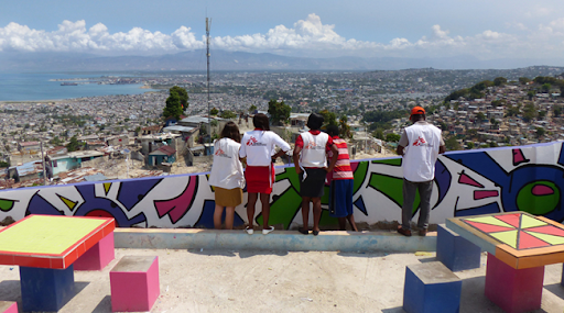
Canaan, one of the most populated areas in Haiti, continues to evolve and grow. In December 2017, the American Red Cross recently covered 35 square kilometers of this area with new drone imagery to assist with population estimates, disaster preparedness programming, and updating OpenStreetMap.

23 March 2018 | by Dale Kunce
Microsoft Philianthropies funds improvements to Missing Maps leaderboards.

11 December 2017 | by Dale Kunce
American Red Cross grants $25,000 to OpenSteetMap to ensure the resilience during disasters.
08 December 2017 | by Rachel Levine
Thank you for your incredible efforts organizing this year's OSM GeoWeek!

07 November 2017 | by David Luswata, Emily Eros, and local contributors
Mapping in West Africa continues, thanks to dedicated OSM communities in Liberia, Guinea, and Sierra Leone. Here's what they are planning for GeoWeek 2017.

18 September 2017 | by Ashley Schmeltzer
This spring and summer, the American Red Cross led training-of-trainers in Belize and Jamaica to build the mapping skills and knowledge of local Red Cross and government staff - here's a quick update of our work.

13 September 2017 | by Heather Leson
We are excited to welcome the newest member of Missing Maps: the International Federation of Red Cross and Red Crescent Societies (IFRC). This is a cross-post from the IFRC's official announcement.

05 September 2017 | by Rachel Levine
Share your chapters' lessons learned with the wider Missing Maps community by filming a short 5 minute video on Tips and Tricks for Hosting a Mapathon. Winning video will be featured on the Missing Maps website.

10 August 2017 | by Emily Eros, Ashley Schmeltzer
Measles is one of the most contagious diseases ever known and it is a leading cause of death among children. In June, the American Red Cross supported a measles and rubella immunization campaign in Malawi that targeted nearly 8 million children.

27 July 2017 | by Dan Joseph
In May 2017, the American Red Cross and Philippine Red Cross collected detailed aerial and street-level imagery of areas that have been part of a 3-year Typhoon Haiyan (Yolanda) recovery program.

26 July 2017 | by Emily Eros, Seth Fitzsimmons
We are pleased to announce a new and improved version of POSM – now faster and slicker than ever!

10 July 2017 | by Geoffrey Kateregga
What connects Kampala and Istanbul? You might be thinking that Kampala and Istanbul are worlds apart, but volunteers in both cities rallied around a common cause for World Refugee Day - working together to map priority areas in Uganda that require urgent humanitarian assistance.

30 March 2017 | by George Washington University
Faculty and students at the George Washington University teamed up with the Pan American Development Foundation (PADF) this March to bring digital mapping tools to vulnerable communities in Guatemala.

03 March 2017 | by Matt Gibb
Validating tasks is an important part in the Missing Maps process, and we encourage everyone to take part. Learn how you can improve your mapping and contribute to validation! #ValidationFriday

24 February 2017 | by Dale Kunce
Portable OpenStreetMap (POSM) can run in the cloud. This walkthrough will help you get your own POSM up and running on Amazon EC2.

20 February 2017 | by Janet Chapman
I first met Rhobi in a building site in Mugumu, Serengeti, Tanzania, in September 2014 where she was desperately trying to get a Safe House for girls refusing Female Genital Mutilation finished before the "cutting season" started in December. In the week we spent together I accompanied her and her team as they visited the surrounding villages, telling the villagers the dangers of FGM through debates, drama and dance. Rhobi almost bled to death from FGM in one of these villages as a 13 year old and has been a passionate advocate for womens' rights ever since.

24 January 2017 | by Matthew Gibb, Emily Eros
Wrapping up our largest undertaking since the start of the Missing Maps project was in West Africa. Covering an area the size of Switzerland, volunteers in Liberia, Guinea, and Sierra Leone visited over 7,000 communities in an area that saw the worst of the Ebola crisis in 2014 and 2015.
18 January 2017 | by Dale Kunce
Since its launch in 2014, Missing Maps has engaged almost 20,000 mappers, helped 430+ public mapathons, put 29 million people on the map, and mapped an area equal to the size of Sweden. We've added many new partners to help try and map the world. Thanks to everyone out there who's been a part of this amazing project!

07 January 2017 | by Emily Eros
Red Cross volunteers on motorbikes logged 72,000 km of GPS tracks during border mapping in West Africa. We used these data to get under the clouds and add roads to OSM that can't be seen from satellite imagery. These roads connect some of the most remote communities in the region. Here's how we processed the dataset and what we were able to do with it.

06 January 2017 | by Emily Eros
This past spring/summer, over 100 Red Cross volunteers conducted field mapping in the border regions of Guinea, Liberia, and Sierra Leone. In addition to the actual mapping, we also set the volunteers' phones to record their GPS tracks each day, and we set their phones to automatically collect cell signal strength data using OpenSignal, an app which crowdsources this information. We haven't come across much about working with OpenSignal data, so this post documents our workflow for using the data, the challenges we had, and our results.

28 November 2016 | by Rachel Levine
Thank you for your incredible efforts organizing this year's OSM GeoWeek! In total 140 public and 150 private events took place in 42 countries. We made 1 million edits and added 861,865 buildings and 145,030 km of roads to OSM. Thanks to your hard work, almost 4,000 new mappers joined the OSM community!

16 November 2016 | by Dale Kunce
In our humanitarian mission we are data omnivores, within licensing restrictions of course, constantly looking for datasets that can aid our mission and the larger mapping community. Collaborating with Facebook is an obvious step for us to take. Using the data created by Facebook volunteers will waste less time checking out a task to find an area with nothing to map.

01 November 2016 | by Dale Kunce
The next step in data analytics is coming to Missing Maps. Using the infrastructure we continue to build out on the Missing Maps leaderboards and osm-stats-api we are very happy to announce the creation of partner pages. Partner pages can be any sort of partner from some of Missing Maps corporate partners such as JP Morgan Chase to local groups such as Maptime.

07 October 2016 | by Emily Eros
Missing Maps members are gearing up for OSM Geography Awareness Week this Novmber, hoping to support over 100 mapathons around the world!

16 September 2016 | by Chris Glithero, Paul Knight, Kat Hicks
The Danish, Swiss and British Red Cross are currently working together to support the Guinea Red Cross in developing integrated, high quality programmes, and the Reproductive Health and Rights Programme is one of these. It aims to improve knowledge and access to reproductive health and rights in the Moyenne Guinée region of the country.

02 August 2016 | by David Luswata
After initially sending volunteers to record all the population centres in the border regions, we then selected some emerging cities in Liberia, Guinea and Sierra Leone to map in their entirety. Volunteers spend hours and days moving from one corner of the city to the other mapping every mappable entity, capturing every detail.

01 August 2016 | by Pete Masters
Following the excellent feedback so many of you sent us, our team has been hard at work to get the next update out. Get the details, here!
22 July 2016 | by Pete Masters
We have had an amazing response to MapSwipe in terms of the mapping you have done, but also your feedback and bug reports. We are listening! Find out here what we are doing to address the most common issues.
18 July 2016 | by Pete Masters
MapSwipe relies on users being able to interpret what they see in the satellite imagery provided. This tutorial gives some guidance on how best to do that.
14 July 2016 | by Pete Masters
MapSwipe enables anyone with a smartphone to contribute to the mapping of these vulnerable communities. Download the app, choose a mission, read the instructions and get started!

11 July 2016 | by David Luswata
Our work in the recent couple of months has been to map communities in a 15 kilometre buffer of the borders of Sierra Leone, Liberia and Guinea – this was the region most affected by Ebola Virus Disease. This has been achieved over and above our expectation. Each of these countries has had its challenges in mapping the communities, but the successes supersede the somewhat expected challenges.

06 July 2016 | by Dale Kunce
As the blog expands we added an atom feed so you can subscribe and get the latest updates on Missing Maps.

28 June 2016 | by Rupert Allan
Sierra Leone Red Cross volunteers are methodically surveying the missing, misnamed, and unrepresented villages of the border region for the Post-Ebola Community Rebuild project. Spearheaded by Missing Maps, it is a fundamental vulnerability assessment of at-risk areas where epidemics and natural disasters can run and spread for weeks un-checked.

07 June 2016 | by Matt Gibb
Drought has been a common occurence in Southern Africa due to climate variability, driven primarily by the El Niño Southern Oscillation in the Pacific Ocean. This significantly increases the vulnerability of people living in rural areas. Since 2011, the American Red Cross has partnered with the Zimbabwe Red Cross Society, to identify and mitigate hazards, and to implement resiliency projects in the region.

02 June 2016 | by Dale Kunce
Building an understanding of gaps left to be mapped means understanding what and how local OSM communities have been able to map. Working with some partners we created a simple Tableau visualization that shows the growth of road data in OSM over the past eight years.

05 May 2016 | by Dale Kunce
Welcome to the new Missing Maps Blog. Over nearly the last two years you almost 10,000 mappers have contributed over 22 million edits, almost 3 million buildings and 300,000 km of roads. These achievements are truly amazing. The new blog will focus on sharing some of the personal stories and major events happening with Missing Maps.

25 April 2016 | by Emily Eros
This past year, the American Red Cross undertook its biggest field effort to date: launching a mapping hub in West Africa and training local volunteers to field map over 5,000 villages in the border regions of Liberia, Guinea, and Sierra Leone. The mapping focuses on public health resources, different aspects of vulnerability, and amenities like markets that would draw people across borders – important information to understand if another Ebola outbreak were to occur.

29 March 2016 | by Drishtie Patel, Matt Gibb
Every year in the Americas more and more people are living in conditions of vulnerability to natural hazards and climate change. To help reduce disaster risk and enhance community resilience in the region, the American Red Cross is working with Red Cross partners like the Colombian Red Cross to address local hazards and vulnerabilities in dozens of disaster-prone communities.

15 September 2015 | by Drishtie Patel, Dan Joseph
Khayelitsha is home to roughly 400,000 people, covering an area of 39 square km that includes some older "formal" areas and a majority of newer, informal settlements. Red Cross partners have been working in the area and looked into the major concerns the community is facing. Fires are at the top of the list. Red Cross partners are piloting a project to solve this issue : a low-cost, meshed network of smart home sensors affixed to each home within the informal settlement. The American Red Cross GIS team recently set out to Khayelitsha to support the community in mapping the area for better program planning and decision making.
