The Canadian Red Cross Society’s Missing Maps activities put digital mapping in the hands of community members to put Canadians in rural and remote regions on the map.
The Canadian Red Cross Society became a member of Missing Maps Project in 2017. Our goal was to partner with rural, remote and Indigenous communities in Canada and improve their available maps to increase their resiliency when faced with emergencies. A two-year pilot project to test out this goal is wrapping up at the end of this month – March 2020. The pilot project is part of an ongoing commitment to working alongside communities to increase disaster preparedness and resiliency.
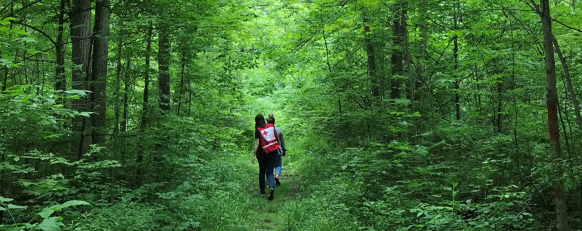
Mapping an educational trail with a pilot community.
When sharing our project with those that are familiar with Missing Maps, many people were surprised to hear that this project was being carried out in a developed country like Canada. Canada has most basic map features mapped across the country such as place names and main roads. However, outside of large cities and tourist destinations, many Canadian communities are not well represented on publicly available maps. The lack of comprehensive publicly available maps leads to a gap in knowledge during emergencies and an opportunity for the Canadian Red Cross to employ Missing Maps methodologies to support Canadians.
There are many reasons that publicly available maps in Canada are not accessible in rural and remote communities. The main reason stems from Canada’s geography. It is a very large country with a relatively small population. The population is even smaller outside of the cities and in the Northern regions of the country. While strong OpenStreetMap communities exist in Canada, most mappers live in the cities and their efforts are concentrated in urban areas. There is simply too much land and too many small settlements for Canadian OSM mappers to tackle.
It is common for small rural and remote communities not to have comprehensive digital maps of their area because they lack the resources to support the technology and workforce necessary to complete the mapping. OpenStreetMap offers a free and volunteer-led solution to this problem. While the dedicated efforts of the few Canadian OSM mappers have made a large impact, they are not able to get the full picture of a community unless they are very familiar with it. As a result, the mapping of many small communities in the country does not reflect the complete picture of communities themselves unless there is input from their local residents.
This issue is compounded in Indigenous communities, which are greatly underrepresented in the Canadian OSM community. Indigenous communities in Canada are often located in remote parts of the country and are both culturally and politically distinct from non-Indigenous communities. Not only are the physical features missing from public maps of most of the 600+ Indigenous communities in Canada, but the cultural perspectives are also absent.
The lack of accessible maps for rural, remote and Indigenous communities poses a safety issue when they are faced with emergencies and natural disasters. When these communities face large emergencies, they are often supported by emergency responders from outside of the community. These outsiders are likely very unfamiliar area and would have a difficult time navigating without a map. If an ambulance driver is looking for a house in an unfamiliar rural community, navigating without a map can significantly increase the response time. Furthermore, cell phone coverage in these areas is often unreliable which causes further delays in emergency response.
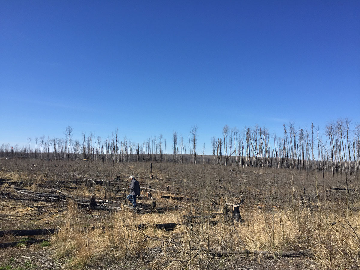
Field mapping with a pilot community in an area that is recovering from a severe wildfire.
Canadian remote communities are commonly located in rugged parts of the country that are closely tied to the wilderness. Should they be impacted by a disaster such as a wildfire or flood, not only could the affects be severe, but the geographic nature of remote communities could make them exceptionally difficult to access. They may only have one road leading into the community; and it could even be made of ice and only usable in the winter. Some communities are only accessible by boat or air. Should these places be impacted by a sudden disaster, it is incredibly important that they are self-reliant. Having a map of the community that local planners can use to track assets, hazards and vulnerable populations could improve their ability to plan for and respond to a disaster.
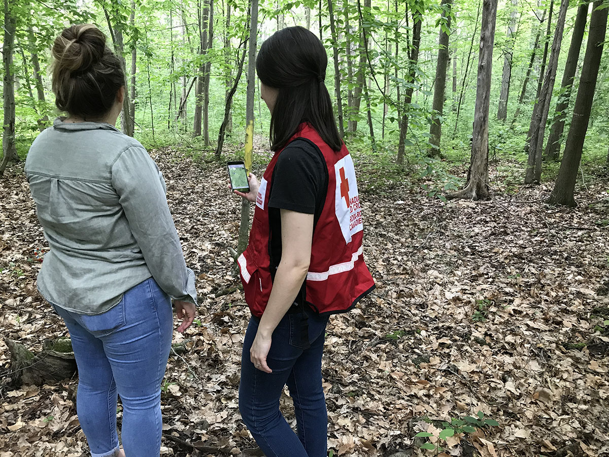
The Canadian Red Cross Society’s domestic Missing Maps activities help address these challenges and bring about an opportunity to enrich OSM with local information. As part of our Disaster Risk Reduction program, the Canadian Red Cross Missing Maps pilot project includes partnerships with rural, remote and Indigenous communities to improve their ability to plan for emergencies by mapping together.
Training community members in OSM also brings about the opportunity for communities to reclaim and take ownership of the publicly available maps of their land and people. With Indigenous communities in particular, there is the opportunity to enrich OSM by creating cultural categories, adding local house numbers that are not a part of the civic addressing system and including the traditional names and languages that they use and recognize within their community.
Through the pilot, the Canadian Red Cross has mapped over ten rural, remote and Indigenous communities in four provinces across the country. With the Missing Maps pilot wrapping up at the end of this month, the Canadian Red Cross Society will be evaluating the program with the hopes of expanding the activities to more communities in Canada.