MapSwipe change detection analysis in response to Cyclone Batsirai Madagascar 2022
To respond to the cyclone emergency in Madagascar, Médecins Sans Frontières (MSF) used a new MapSwipe method developed by the Heidelberg Institute of Geoinformation Technology (HeiGIT) and Laurent Savaete, a long-time MapSwipe software engineer. This innovative function saw the light thanks to the funding support of the Humanitarian OpenStreetMap Team and the assistance of amazing volunteers with translations.
Introduction
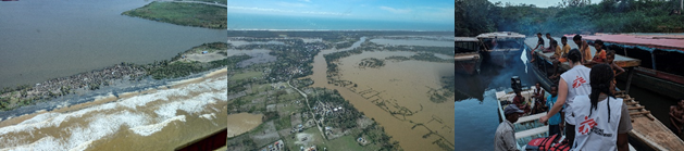
Between the 5th and 22nd of February 2022, tropical cyclones Batsirai and Emnati hit Madagascar’s east coast, destroying, and flooding numerous medical and non-medical sites such as hospitals, schools and residential houses. It is estimated more than 300,000 people have been affected.
Madagascar has faced numerous extreme weather events in recent years. Southern Madagascar before the cyclone was still recovering from the effect of an exceptionally severe drought, which caused alarming levels of malnutrition.
In response to the cyclones, MSF teams began providing healthcare to areas most affected. Their challenge on the ground was to identify the specific areas which have been flooded or damaged by the cyclone and a tool with the ability to assist MSF in this challenge was MapSwipe’s new change detection project type.
.jpg)
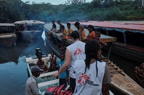
MSF exploratory missions in Madagascar after the 2022 cyclone Batsirai.
MapSwipe
MapSwipe is an open-source mobile app to make mapping around the world more coordinated and efficient. MSF, British Red Cross, Humanitarian OpenStreetMap Team, American Red Cross, and the Heidelberg Institute of Geoinformation Technology (HeiGIT) have contributed to its creation, development, and maintenance. In the original MapSwipe ‘build area’ mission type, users swipe through satellite images and tap an imagery tile once when they’ve located particular features such as buildings.
In the spring 2021, MSF created six projects of this type to identify where buildings were in rural areas to help plan its activities in southern Madagascar. With the results, MSF set up HOT Tasking Manager projects and with Missing Maps volunteers mapped buildings and residential areas throughout the following months.
MapSwipe new project type: Change Detection
The new project type allows detection of flooding and building damage to be identified remotely.
This new function allows users to compare two satellite images and indicate areas of change. For this context, one image before the cyclone and one after the cyclone were used and users were asked if flooding and building damage could be seen.
How this new project type was used in Madagascar
This new project type was used in two areas - Mananjary and Mahanoro, East Madagascar, which had been heavily affected by the cyclone. The users compared two satellite images, one before the cyclone and one after the cyclone.
Once the projects were created, each task only took a couple of days to be completed, which allowed a quick response to the cyclone. Once individual tasks were completed, geo analysis was performed on the MapSwipe data to individual buildings and places of interest, which have been affected by either flooding or damage.
The MSF Missing Maps team sent these maps to the Head of Mission of the projects in Madagascar, where the field team then used them to plan humanitarian assistance to the affected areas.
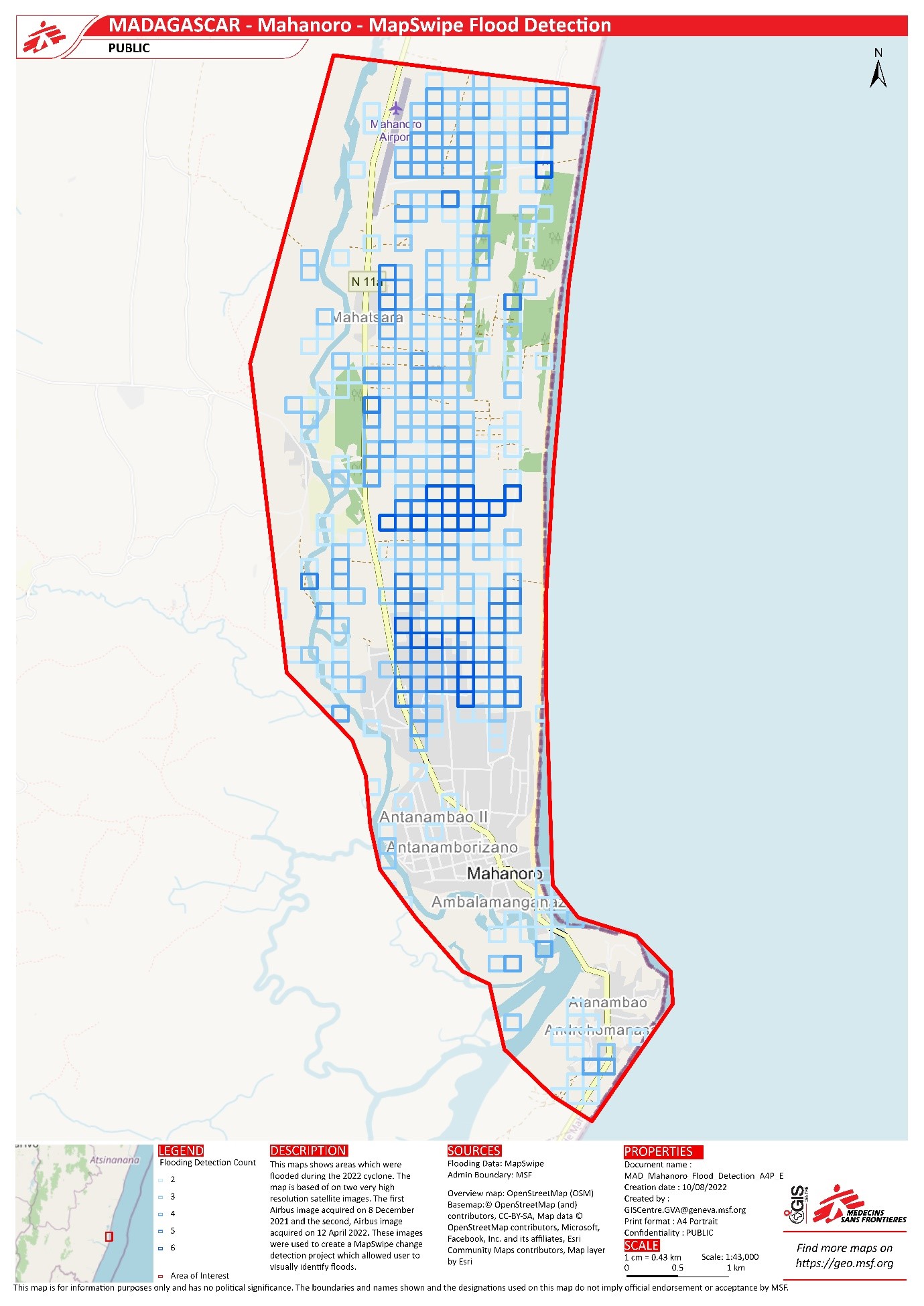
Map showing areas which were flooded during the 2022 cyclone in Mahanoro, Madagascar.
Join in!
Download the MapSwipe app for Android or iOS and tell us what you think. Look for a mission with “OSM building validation” in the title to check out the new mission type. Please click the green “Tutorial” button from the mission page and learn about contributing before starting to map.
Follow @mapswipe on Twitter.
If you want to be part of the support that keeps the app running, maintained, and free of bugs, the MapSwipe team accepts financial contributions via Open Collective.
If you code, check out the project on GitHub and see if there are any issues you can tackle. Email info@mapswipe.org if you would like to be added to the Slack workspace for the MapSwipe community.